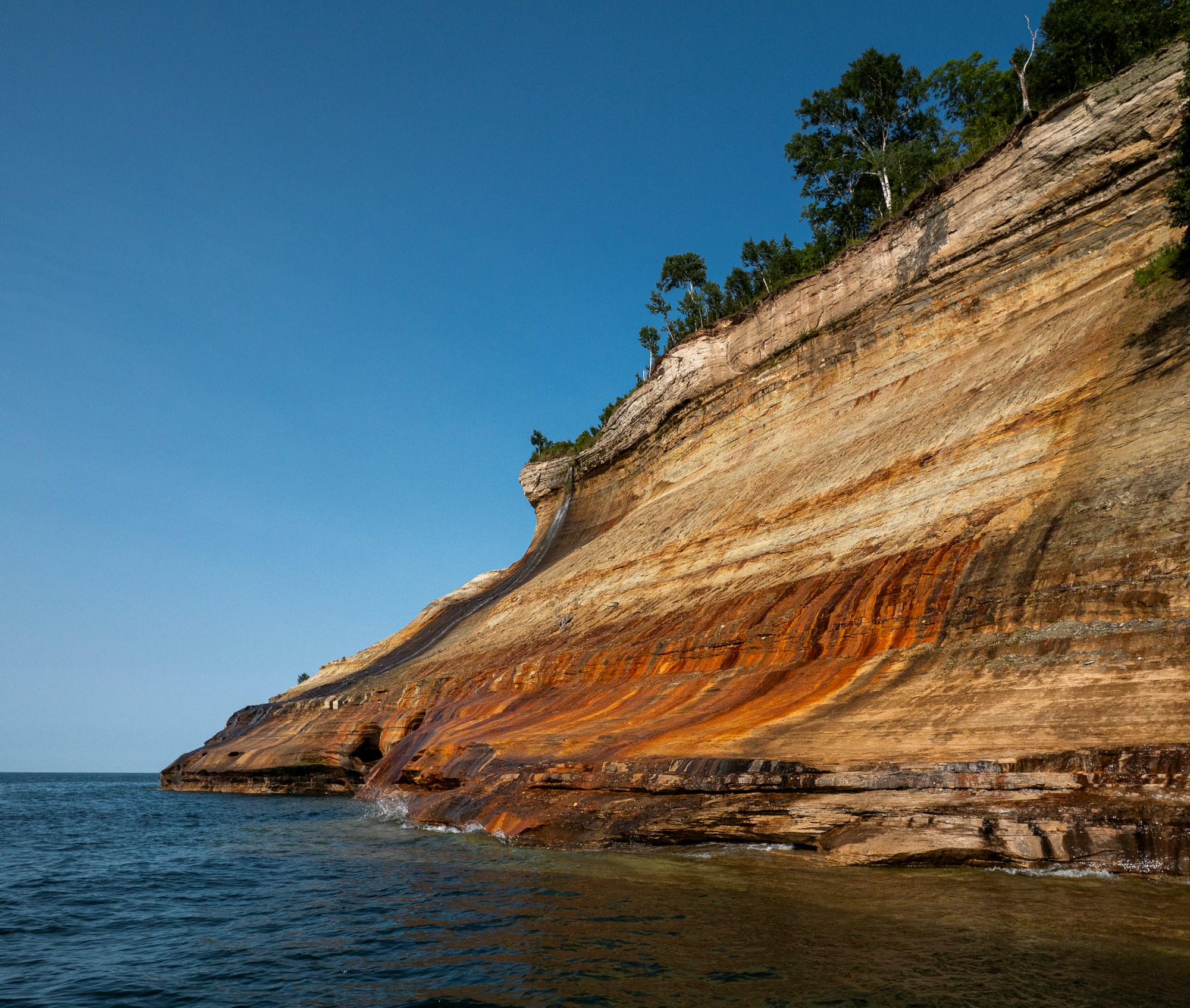
Pictured Rocks National Lakeshore earns the drive with mineral-streaked cliffs, Lake Superior beaches, waterfalls, deep forest, and one of Michigan’s best full-day loops. It also stretches across the shoreline between Munising and Grand Marais. The useful move is to pick one anchor hike, leave room for weather, and save the map before your signal disappears.
How many days do you need at Pictured Rocks?
With one day, stay near Munising and pair Miners Castle, Miners Beach, and a waterfall with a boat tour or shorter hike. With two days, let Chapel Loop anchor the trip. A third day makes room for Grand Sable Dunes and the quieter east side—or just lets you wait out wind and rain without turning the weekend into a schedule fight.
Check the lake, then commit
The lakeshore is generally open year-round, but roads, trails, water access, and facilities can close seasonally or unexpectedly. Check the official Pictured Rocks current conditions and the forecast before driving to a trailhead. A saved plan is useful. A current plan is better.
What are the best hikes at Pictured Rocks?
Chapel Basin Loop
The signature Pictured Rocks hiking route. Expect forest, waterfalls, shoreline, sand, exposed cliff views, and enough distance that water, food, layers, and an offline map belong in your pack. It is a real day, not a scenic stroll that got ambitious. Stay well back from cliff edges; erosion can leave unsupported ledges.
Miners Castle and Miners Beach
This is the high-return, lower-commitment option. Start with the accessible Miners Castle overlooks, then add Miners Beach or a nearby trail according to your time. It works well for mixed-ability groups and for days when a full loop is not the right call.
Waterfall stops near Munising
Munising Falls and Miners Falls fit around an arrival day, a longer hike, or an itinerary the weather has already edited for you. Confirm current access before building the day around a specific waterfall.
Use the NPS Pictured Rocks hiking guide for official distances, closures, and route updates.
A two-day Pictured Rocks plan that leaves room to breathe
Do you need camping reservations or permits?
The drive-in campgrounds are rustic: no electric hookups, hot water, or showers. Backcountry sites are assigned, so mileage and campsite availability have to be planned together. Reserve before the trip, then review the current food storage, water treatment, fire, and group-size rules. This is one part of the trip that does not improve with improvisation.
Start with the official Pictured Rocks camping guide and backcountry planning page.
Weather and what to pack
- Offline NPS map or printed map
- Water plus a filter or treatment backup
- Rain shell and insulating layer
- Sun protection and insect repellent
- Trail food beyond the planned finish time
- Headlamp, even for a day hike
- Basic first aid and blister care
- Battery bank and charging cable
- Dry bag for boat or kayak days
- Trash bag for every scrap you carry in
Many parts of the park have limited or no cell service. Download the official Pictured Rocks map before the visit and carry a paper backup for a longer route. Your phone cannot load a map with optimism.
Can you kayak at Pictured Rocks?
For most first-time visitors, an authorized guided trip or commercial boat tour is the lower-stress way to see the cliffs from the water. If paddling independently, use a proper sea kayak, wear a PFD, dress for immersion, carry communication and safety gear, file a float plan, and turn around early when wind or waves build. Read the NPS kayaking and boating guidance before launching.
Cold water is the rule
There are no lifeguards at park beaches, and Lake Superior remains cold even when the sand feels warm. Treat swimming and paddling as cold-water activities.
Are dogs allowed at Pictured Rocks?
Check the current Pictured Rocks pet map and rules before choosing a route. Do not assume that a road-accessible trail or beach permits dogs.
Pictured Rocks trip-planning FAQ
What is the best time to visit Pictured Rocks?
For hiking and camping, late spring through early fall offers the broadest access. Summer brings long days, crowds, and biting insects. Fall can mean color and fewer bugs, but also shorter days and sharper weather. Winter is a separate cold-weather trip with limited road access. Check current conditions either way.
What is the best hike at Pictured Rocks?
For experienced hikers with a full day, Chapel Loop is the strongest all-around route. In 10.5 miles it connects waterfalls, forest, Chapel Rock, beach, and the cliff-lined Lake Superior shoreline.
Can you visit Pictured Rocks in one day?
Yes. Stay on the Munising side and choose Miners Castle, one beach or waterfall, and either a boat tour or a manageable hike. Trying to drive the whole lakeshore is a good way to see a lot of your windshield.
Is there cell service at Pictured Rocks?
Service is limited or unavailable in many areas. Download the official map, reservation details, and directions before entering the park, and carry a paper backup for longer routes.
Do you need a reservation to enter Pictured Rocks?
A day visit does not currently require a timed-entry reservation, but a park pass is required. Every drive-in campsite requires a reservation, and every backcountry overnight requires a permit. Verify the current fees and pass requirements before the trip.
Are the cliff overlooks safe?
They require caution. Cliffs can be unstable and have unsupported ledges, and many areas do not have guardrails. Stay on designated trails and viewing areas, keep children close, and remain well back from every edge.
Check the official word
This guide uses National Park Service information for safety, access, reservations, and rules. Those details can change. Check them again shortly before the trip.